
Total ParcelAtlas Layer REBUILD Now Complete
All Parcel Boundaries Now Assigned a OGC Compliant Plus Code Based NPN
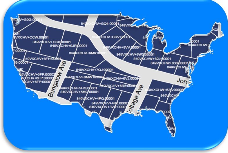
Mill Valley, CA April 13 – Boundary Solutions is particularly pleased to announce a TOTAL REBUILD of ParcelAtlas deployed on ArcGIS Online is now complete with every parcel boundary assigned an NPN with a Plus Code as its locational component. [An extra benefit, all property attributes are brand new.] This brings the NPN National Repository universally compliant with Open Geospatial Consortium’s candidate Parcel ID Standard being considered for worldwide adoption. Goodbye Descartes’ lat long points, hello Open Location Code cells.
BIG Turning Point.Taking over four months to complete, before the National Parcel Number Assignment Service API could only be applied on a hit and miss basis. Now it can add a Plus Code Based NPN to any record relating to near any parcel in the US, 100% in urban areas. Recently, NOMADICS, a BSI business partner, successfully tested an UNLIMITTED version of the NPNAS API. According to Jose Carrillo, NOMADICS GIS Manager,
“The sample database in all cases was a compilation of 63,404 vacant commercial properties throughout Florida valued at <$10,000. Assigning a NPN to these records, at a minimum, facilitates easier identification of the properties best suited for acquisition, sale, development, and redevelopment. That the property’s NPN is predicted on a specific geographic location independent of disjointed county records, the user does not have to do any work to find out in which county a specific parcel is located.”
Pilot Testing Recruitment. So, do you want to get in on this? The offer still stands. Download the Pilot Version of the NPNAS API [below] and apply it up to 1000 records. As a reword, the unlimited version of the API will be provided for one year of FREE use to take your enterprise to a new level where it could not go before. Better, you do not have to be a ParcelAtlas OR ArcGIS Online Subscriber to do it.
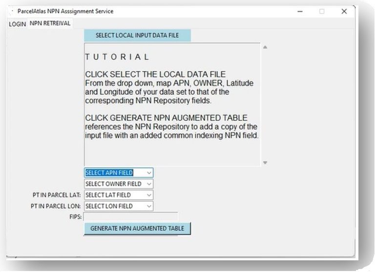
Small First Test. Extract just the APN, Owner Name and point-in-parcel lat long fields in up to 1000 records from a selected data set like the one below. Then download and invoke NPNAS. Follow the Tutorial, and in a matter of seconds, the API, referencing the National NPN Repository, adds a NPN Field as common indexing.
National Parcel Number Assignment Service API
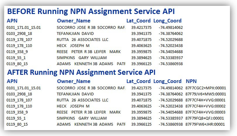
Below is a BEFORE and AFTER example of what a data set looks like once enhance NPNAS API adds an universal land parcel common indexing field. Also, please be reminded that Open Geospatial Consortium is involved in NPN being adopted as the Parcel ID standard worldwide.
● ● ● ●
ParcelAtlas is the only national parcel layer content service INSIDE ArcGIS® Online, weighing in at almost 3000 counties, 151M parcels enhanced with industry leading Quantarium Property Attributes updated weekly. As for functionally, its analytical ability is limited only by the subscriber’s mastery of ArcGIS Pro. Subscriptions are for Live Data, but REST Subscriptions are available at commodity prices, easily implemented using the vast array of ArcPro tools. Parcel Boundaries are updated annually or better, property attributes, WEEKLY. NPN is a BIS exclusive.