
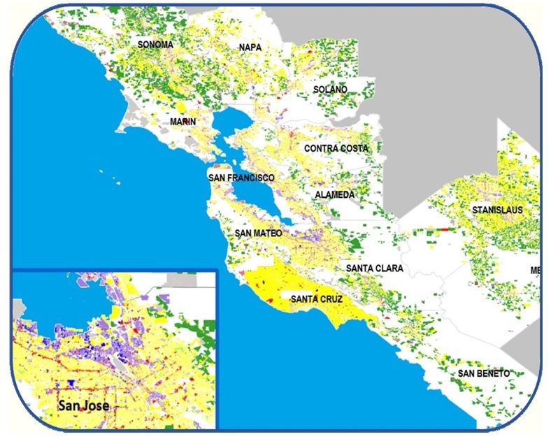
Normalized Use Codes assigned to every one of the 2.7 Million parcels in this Bay Area Transportation Study Region made this Mineta Transportation Institute Study possible. Knowing the land use of each trip end derived from iPhone GPS data enabled the separation of commute trips from all others, greatly improving the accuracy of the study results. CLICK HERE to see the USE CODE Designation applied the same to very parcel in the USA.
According to Johchen Albrfecht, lead analyst of the Transportation Study,
“We are quite pleased with the quality and completeness of ParcelAtlas property information, particularly the normalized use codes that enabled us to determine commute trips from other according to the USE CODE on each end. We are particularly pleased with BSI’s quick and competent response to our every question that has greatly expedited our progress”
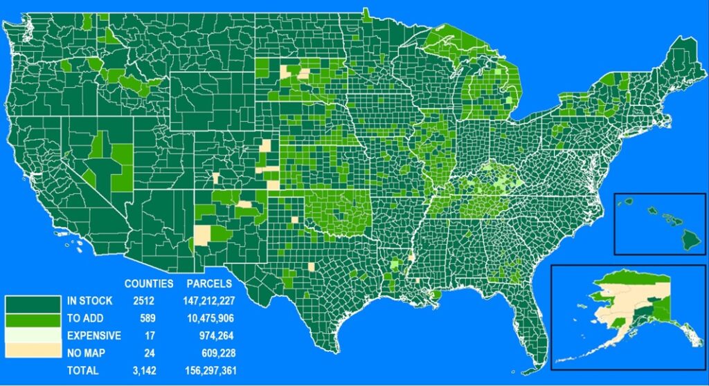
ParcelAtlas Coverage
● ● ● ●
ParcelAtlas is the only national parcel layer content service INSIDE ArcGIS® Online, weighing in at almost 3000 counties, 150M parcels enhanced with industry leading Quantarium Property Attributes updated weekly. As for functionally, its analytical ability is limited only by the subscriber’s mastery of ArcGIS Pro. It is also the home of the nation’s first NPN National Repository, created out of technical necessity, each parcel ID a singularly machine-driven number with no particular bias other than technical necessity. Keeping the NPNs current for over two years, the NPN National Repository is now being reviewed by the Open Data Consortium as a national standard for implementing Universal NPN NPN Compliance, a globally unique persistent parcel ID assigned to every US parcel and related land records.